A digital twin of the Titanic
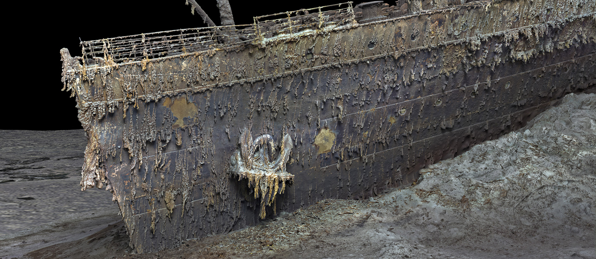
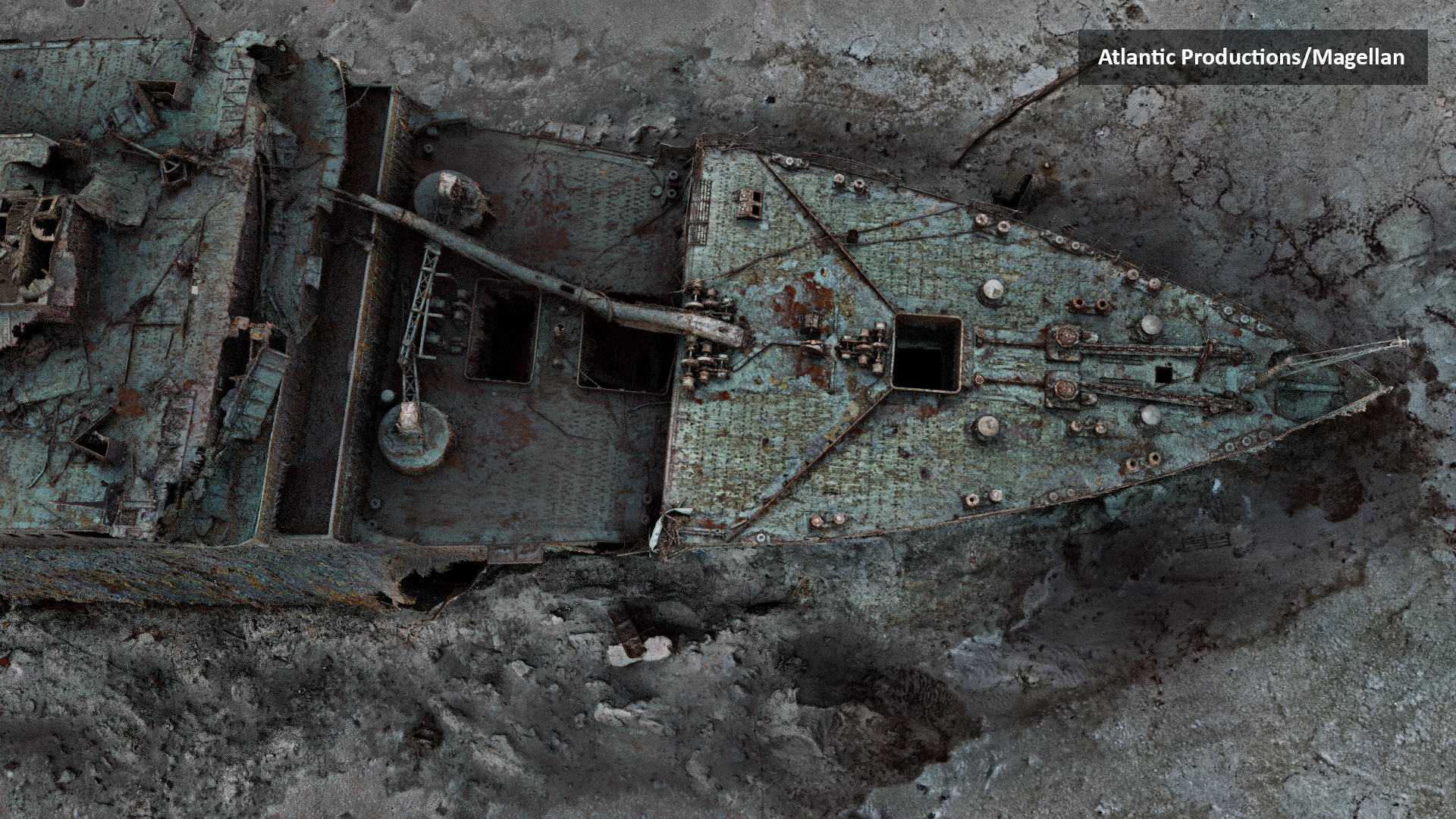
 ou've never seen the wreck of the Titanic like this before. You can make out the finest details, see the bow in all its dimensions, and get a fascinating picture of the legendary ship that rammed an iceberg in April 1912 and sank in the freezing Atlantic on its maiden voyage.
As part of the largest underwater 3D imaging project ever undertaken, researchers worked with British multimedia company Atlantic Productions to map the legendary ocean liner in its entirety. From this data, a "digital twin" was created that shows the wreck in unprecedented clarity. Using technology developed by deep-sea specialist Magellan Ltd, underwater experts have documented the exact condition of the wreck in high-resolution images.
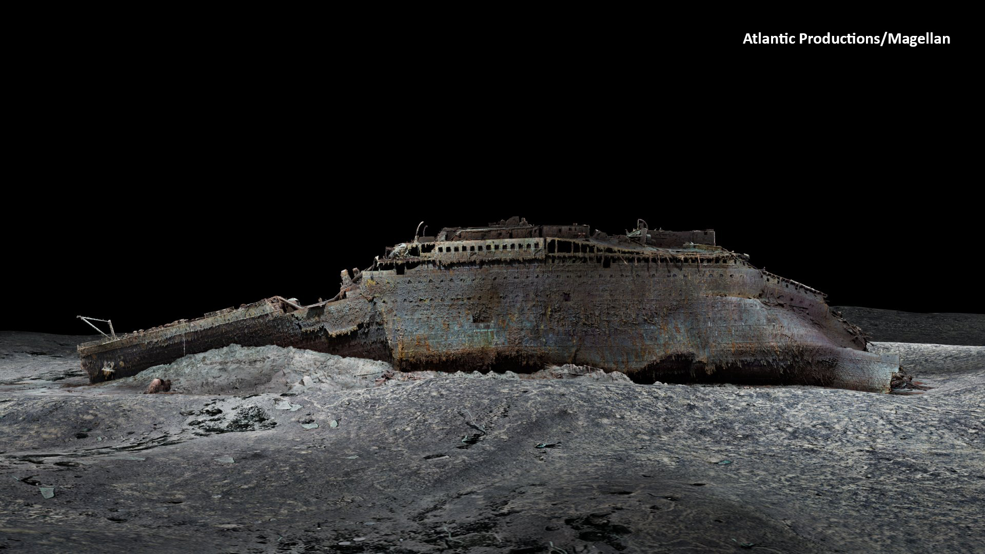
The scans of the now badly deteriorated wreck were carried out during a six-week expedition in the summer of 2022. For this purpose, a special vessel positioned itself in the North Atlantic, 700 km off the Canadian coast. The expedition used two submersibles that spent countless hours at a depth of 3,800 meters to map every millimeter of the wreck down to the smallest detail and to map the entire three-mile debris field. The wreck was not touched in the process.
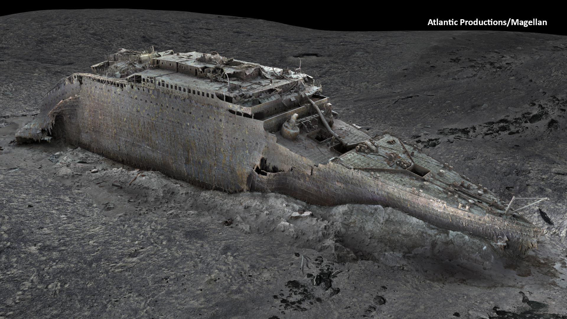
The 3D project required an enormous 16 terabites of data. The experts generated over 715,000 still images and 4K video footage. The mapping covers the entire wreck, including the bow and stern sections that separated during the sinking. The team also documented the large debris field surrounding the wreck with the same level of detail.
Internet: atlanticproductions.tv
Instagram: @atlantic.productions
Twitter: @atlanticprods
Welcome to Photonworld – a platform for knowledge, interesting facts and science on the topic of light. Photonworld aims to provide a basic understanding of the physics of light and its countless phenomena. From medicine, to art and physics: all topics are covered.
Photonworld originated as an initiative of the excellence cluster the Munich-Centre for Advanced Photonics (MAP) and the Laboratory for Attosecond Physics (LAP) at the Max Planck Institute of Quantum Optics (MPQ).


The initiator of the project is Prof. Dr. Ferenc Krausz, Chair of Experimental Physics at the LMU and Director of the MPQ.
Photonworld’s Student Zone reports directly out of the PhotonLab, which is supported by the Munich Center for Quantum Science and Technology (MCQST) and the DFG Research Unit FOR 2783. At the PhotonLab, schoolteachers and students can find up-to-date information about experiments and goings-on at the lab, and plan their own visit to the laboratory.